We left behind Akureyri, the capital of the north, and headed east along Iceland’s ring road. This leg of the journey featured a couple of stops around Lake Mývatn (situated in an active volcanic area, sandwiched between trips to two famous waterfalls.
Stop 1: Goðafoss
Iceland’s wet climate and mountainous terrain are two key ingredients that ensure that its tens of thousands of waterfalls keeping roaring all year round. And while many waterfalls lie far from the main roads, Goðafoss is located right on the ring road and was just too convenient to drive past. Its name translates as “Waterfall of the Gods” – legend has it that the Lawspeaker of Iceland threw his statues of the Norse Gods into the waterfall after declaring Christianity the official religion of Iceland in 1000 AD.
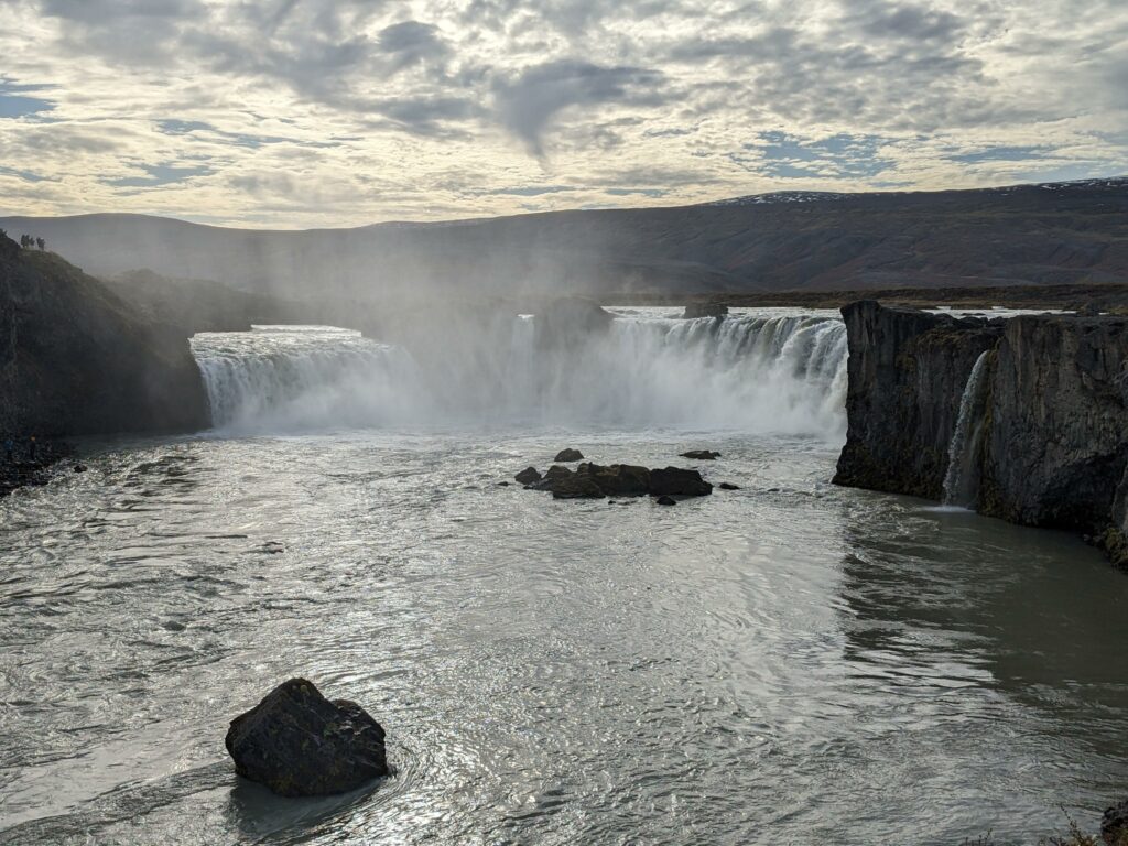
This was an impressive start to our tour of Icelandic waterfalls, but a bit of a lonely stop as Sara and I walked out to the waterfall separately – Alex was fast asleep in the car and we didn’t dare disturb him!
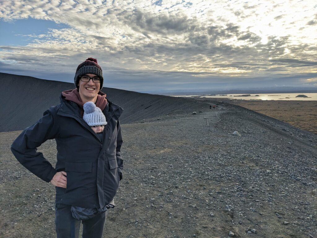
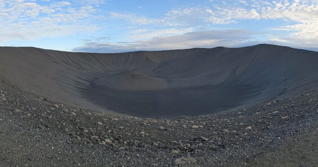
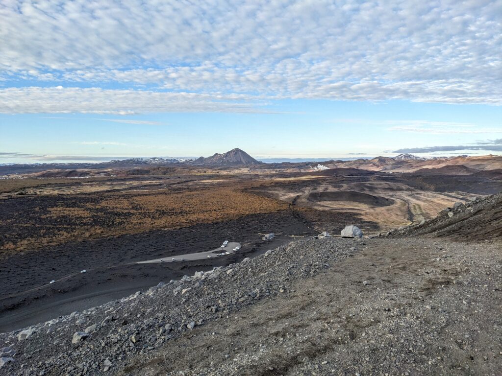
Stop 2: Hverfjall volcano
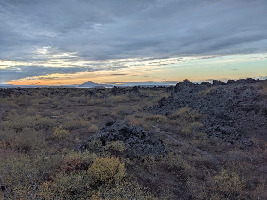
We continued east to Lake Mývatn, which sits in an active volcanic area in northern Iceland. On its eastern shore lies Hverfjall, a perfectly round tuff cone, 1 km in diameter, formed by a volcanic eruption more than 2500 years ago. We clambered up the roughly 100 m of elevation to the rim of the cone and peered into the central crater, which was devoid of any forms of life, giving the whole area the impression that it was only formed yesterday. We spent a few minutes walking around part of the rim and admiring the amazing view across the Mývatn region, before Alex loudly decreed that it was time to return to the car for a(nother) nap.
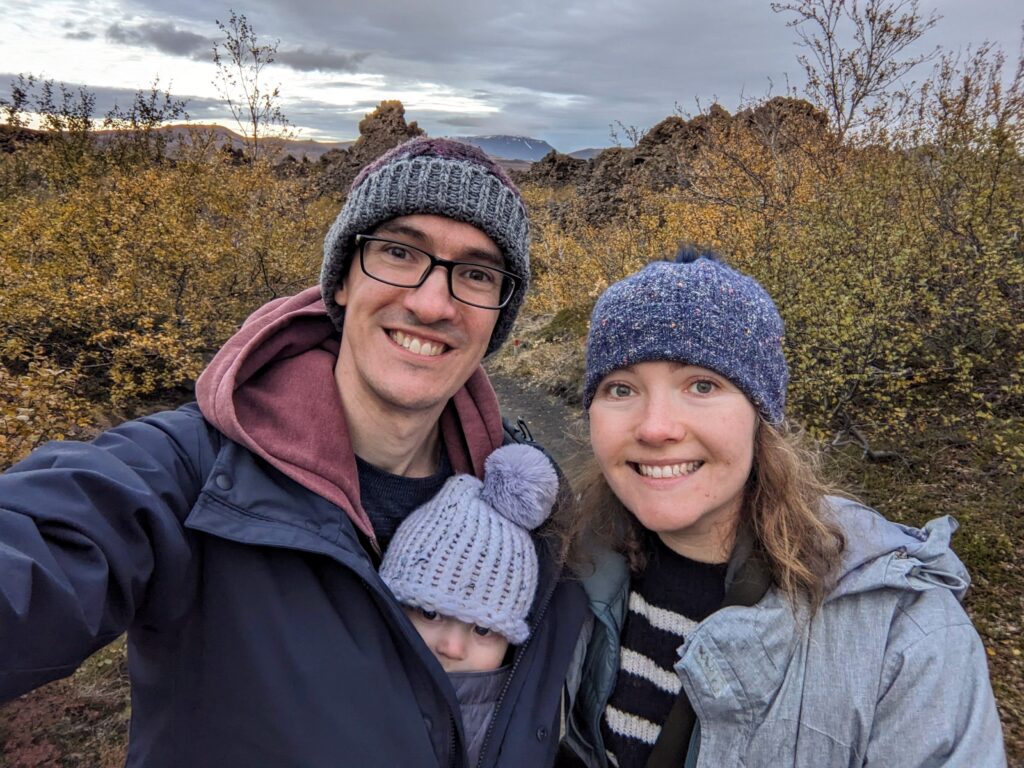
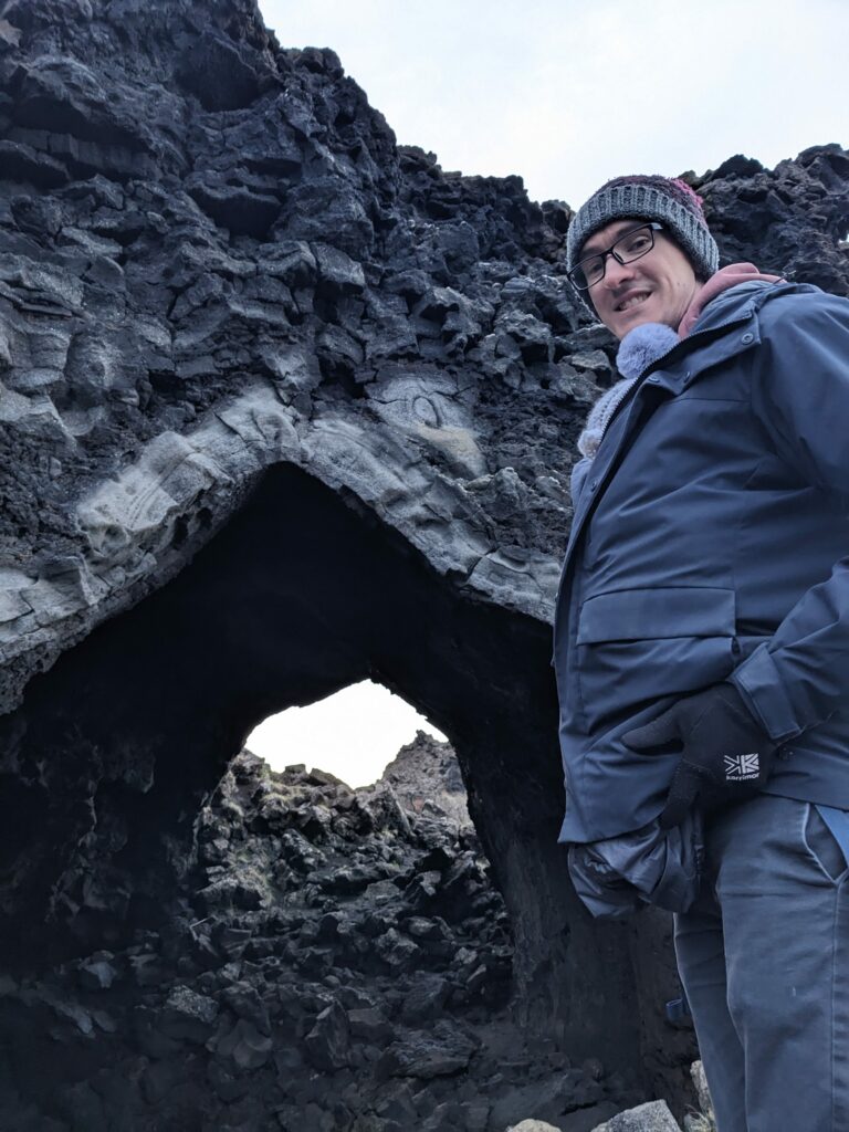
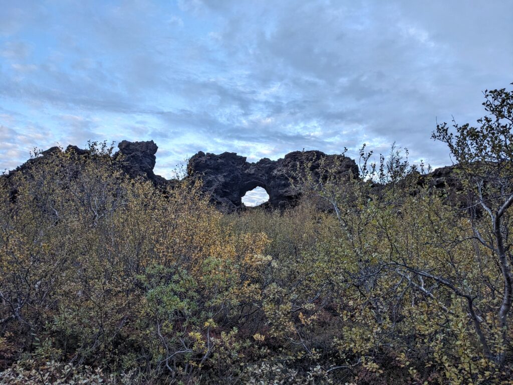
Stop 3: Dimmuborgir lava field
Just between the Hverfjall volcano and Lake Mývatn lies the Dimmuborgir lava field. This lava field was quite different to the mossy, bobbly field we walked through on the Snæfellsnes Peninusula, as it was formed when lava flowed over a lake, boiling the lake’s water and producing water vapour. This water vapour rose through the layer of lava, leaving behind strange columns of rock and other hollow structures. One such structure is “The Church”, a rock cave with an arched roof that looked like it was man-made rather than occurring naturally!
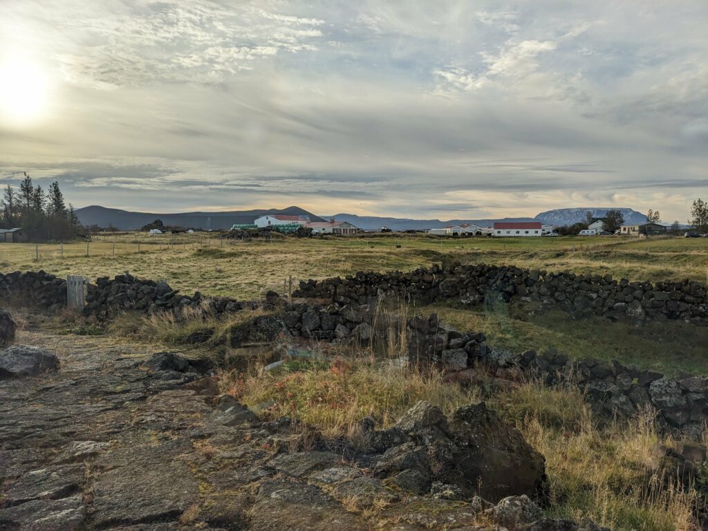
That night, we stayed at the nearby Vogafjós Farm Resort. Here we had the chance to try Geysir bread – a sweet rye bread baked underground using geothermal energy. It was absolutely delicious paired with another local speciality: salty, marbled pieces of smoked lamb. I’d include some food pics but we’re out of practice and forgot to take any, so instead have a view from breakfast instead!
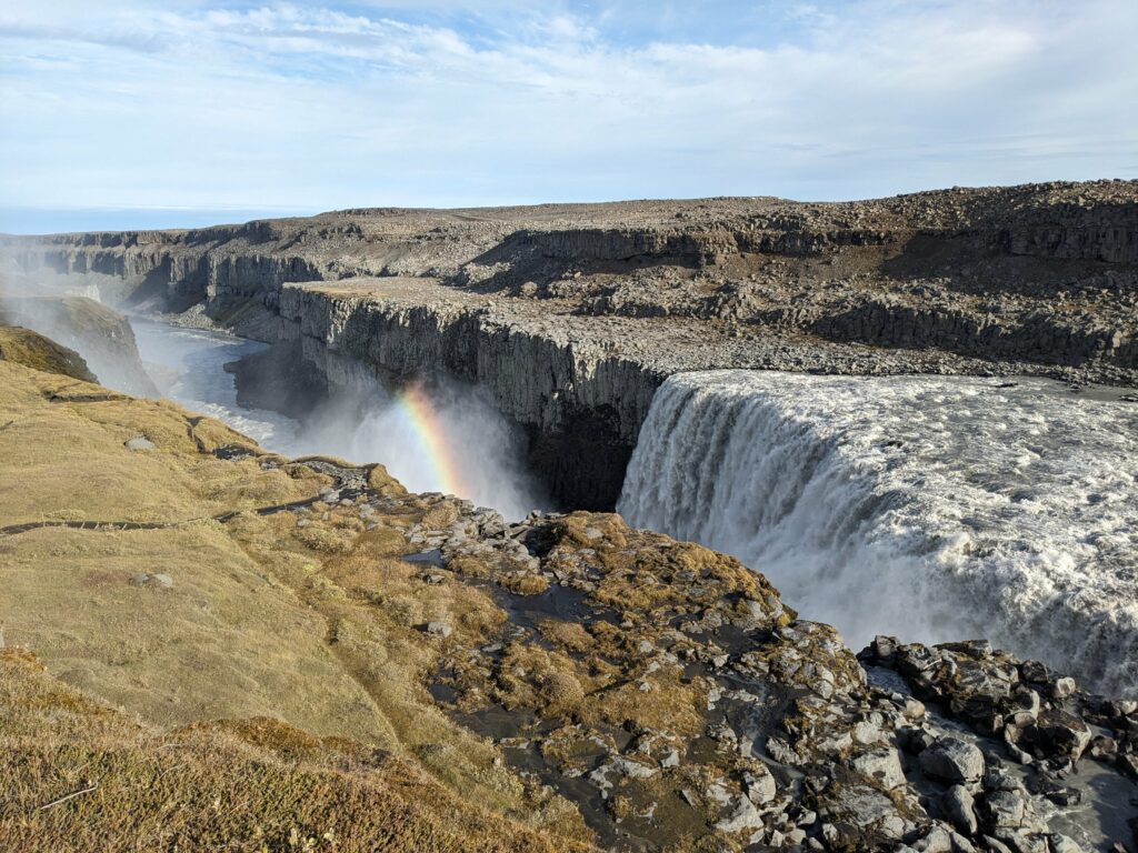
Stop 4: Dettifoss
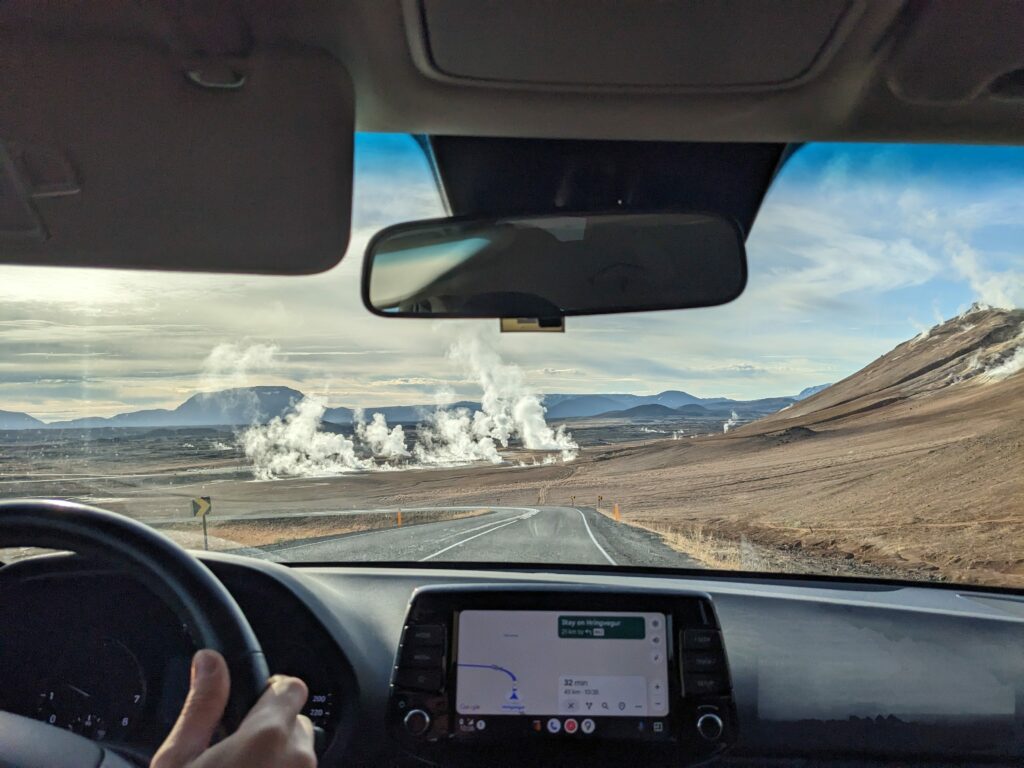
As we left the lake we passed the Hverir geothermal area, which was releasing vast amounts of steam straight from the ground, as well as a rather strong smell of sulphur.
Our last stop in the area was at Dettifoss. This waterfall holds the record for being the “most powerful” waterfall in Iceland, as a product of both its height and flow rate. The weather was cold but clear, allowing the sun’s rays to paint a rainbow in the spray as it was carried away from the waterfall by the wind.
As northern Iceland began to fade into our rear view mirror, it was time to put our foot down as we headed towards Neskaupstadur, a town on one of Iceland’s easternmost peninsulas.